Land surveying is the foundation of every development project. In Texas where terrain, vegetation, and site conditions vary widely accurate surveying is essential for proper planning, engineering, and construction. Traditional methods remain important, but new technologies are reshaping how surveyors capture and analyze site information.
LiDAR mapping, drone imaging, and GIS data systems are now central tools in Texas land development. These technologies allow survey teams to work faster, reduce field time, and deliver highly detailed digital models that support better decision-making from day one.
Why Technology Matters for Texas Surveying
Modern surveying tools make this possible by improving accuracy, increasing efficiency, and enabling teams to capture information that would otherwise take days or weeks to obtain using ground-based methods alone.
Key Technologies Transforming Land Surveying
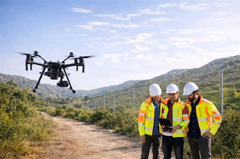
1. Drone (UAS) Surveying
Drones have become a standard tool for capturing aerial imagery and surface data across Texas. They offer:
Faster coverage of large acreage
Safe access to steep, wooded, or difficult terrain
High-resolution imagery for design and planning
Reliable data for stockpile measurements and earthwork tracking
Drones significantly reduce field time and allow surveyors to gather reliable site information before crews even step onto the ground.
2. LiDAR Mapping
LiDAR (Light Detection and Ranging) provides extremely precise elevation and surface data. It is especially valuable in areas with heavy vegetation, where ground features are difficult to measure using traditional methods.
LiDAR supports:
Detailed topographic surveys
Identification of drainage paths
Floodplain and watershed analysis
Road, utility, and grading design
Cut-and-fill calculations for earthwork
Because LiDAR captures millions of elevation points, it delivers a more complete picture of a site than traditional spot elevations or contours alone.
3. GIS (Geographic Information Systems)
GIS is the backbone of modern survey data management. It allows surveyors, engineers, and planners to combine all site information into a single digital environment.
Using GIS, project teams can visualize:
Parcel boundaries and right-of-way limits
Existing utilities
Zoning and land-use designations
Topography and terrain
Environmental features
Floodplain impacts
GIS improves coordination between surveyors, engineers, and project stakeholders, ensuring everyone works from consistent, accurate information.
Benefits for Texas Developers
Technology-enhanced surveying gives developers several advantages:
Higher Accuracy
Drone imagery and LiDAR mapping provide dense, precise data that reduces errors and supports more accurate engineering plans when proper survey control is established.
Faster Start Times
Surveying large or complex sites takes significantly less time, helping developers move into design sooner.
Better Visualization
Point clouds and 3D surface models help teams understand site potential, constraints, and grading needs more clearly.
Reduced Risk
Early identification of elevation changes, drainage concerns, or access limitations prevents problems during construction and reduces costly redesigns.
Improved Documentation
Ongoing drone surveys during construction allow developers to track progress, confirm earthwork volumes, and maintain detailed project records.
Conclusion
Technology is transforming the way land surveying is performed across Texas. Tools like LiDAR, drones, and GIS allow survey teams to deliver faster, more accurate, and more detailed insights than ever before. These advancements don’t replace traditional surveying they strengthen it.
For developers working in a fast-moving Texas market, partnering with a survey team that embraces modern tools can streamline timelines, reduce uncertainty, and improve overall project outcomes.
At Urban Strategy, we are committed to leveraging the best of today’s technology to support smarter surveying, better design, and stronger project outcomes.